Warning number 10 from the Cuban Institute of Meteorology (Insmet) on the trajectory and development of Hurricane Rafael, with winds of up to 160 kilometers per hour, being a category two.
During this morning, Hurricane Rafael continued to gain rapidly in organization and intensity, its maximum sustained winds have increased to 160 kilometers per hour, making it a category two hurricane on the Saffir – Simpson scale.
Its minimum central pressure has continued to fall to 964 hectoPascal, they said from the Insmet at 9:00 am today, Wednesday.
At nine o'clock in the morning, the center of the hurricane was estimated at 21.3 degrees North latitude and 81.9 degrees West longitude, a position that places it 75 kilometers southeast of Punta del Este, Isla de la Juventud, 165 kilometers south-southeast of Cajío beach, Artemisa and 180 kilometers southeast of Dayaniguas beach. Pinar del Río.
This organism has remained during the last hours on a course close to the northwest and has slightly increased its translation speed to 22 kilometers per hour.
This system will continue with a similar course and speed of translation, transiting during the morning through the seas near the Isle of Youth, being able to gain even more in intensity, before penetrating land in the vicinity of the southern coast of the provinces of Artemisa and Pinar del Río.
Insmet and notice on the development of Hurricane Rafael
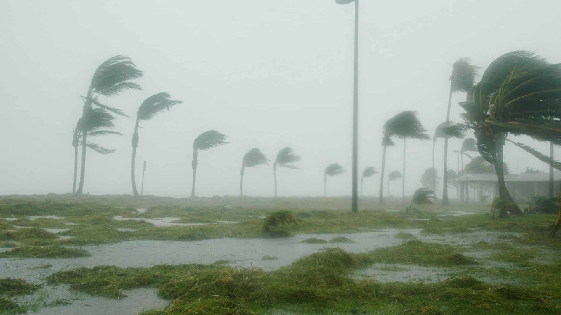
In the last few hours, numerous rains, showers and thunderstorms have been reported in the eastern and central regions, which will increase today in western Cuba.
This rainfall will continue for the next 24 hours, which will be strong and intense, with accumulated between 100 and 200 millimeters, which could be higher in some locations.
In the morning the winds will be from east to southeast in the west and center with speeds between 50 and 65 kilometers per hour, which from the afternoon will be from southeast to south with speeds between 95 and 110 kilometers per hour, with higher gusts.
The winds will reach hurricane force in the areas near the center of this tropical organism during its passage through the western region.
There will be strong swells on the south-central and western coast, with moderate to heavy coastal flooding in the south of the provinces of Sancti Spíritus, Cienfuegos, Matanzas, Mayabeque, Artemisa and Pinar del Río, as well as on the Isle of Youth and the Canarreos archipelago.
Taking into account its proximity to the national territory and the forecast trajectory, the greatest attention must be paid to its future evolution and to the information issued by the Forecast Center of the Institute of Meteorology.
The next tropical cyclone warning will be issued at noon today, Wednesday.